Skip to search
Skip to main content
History
Login
search for
Search
Search
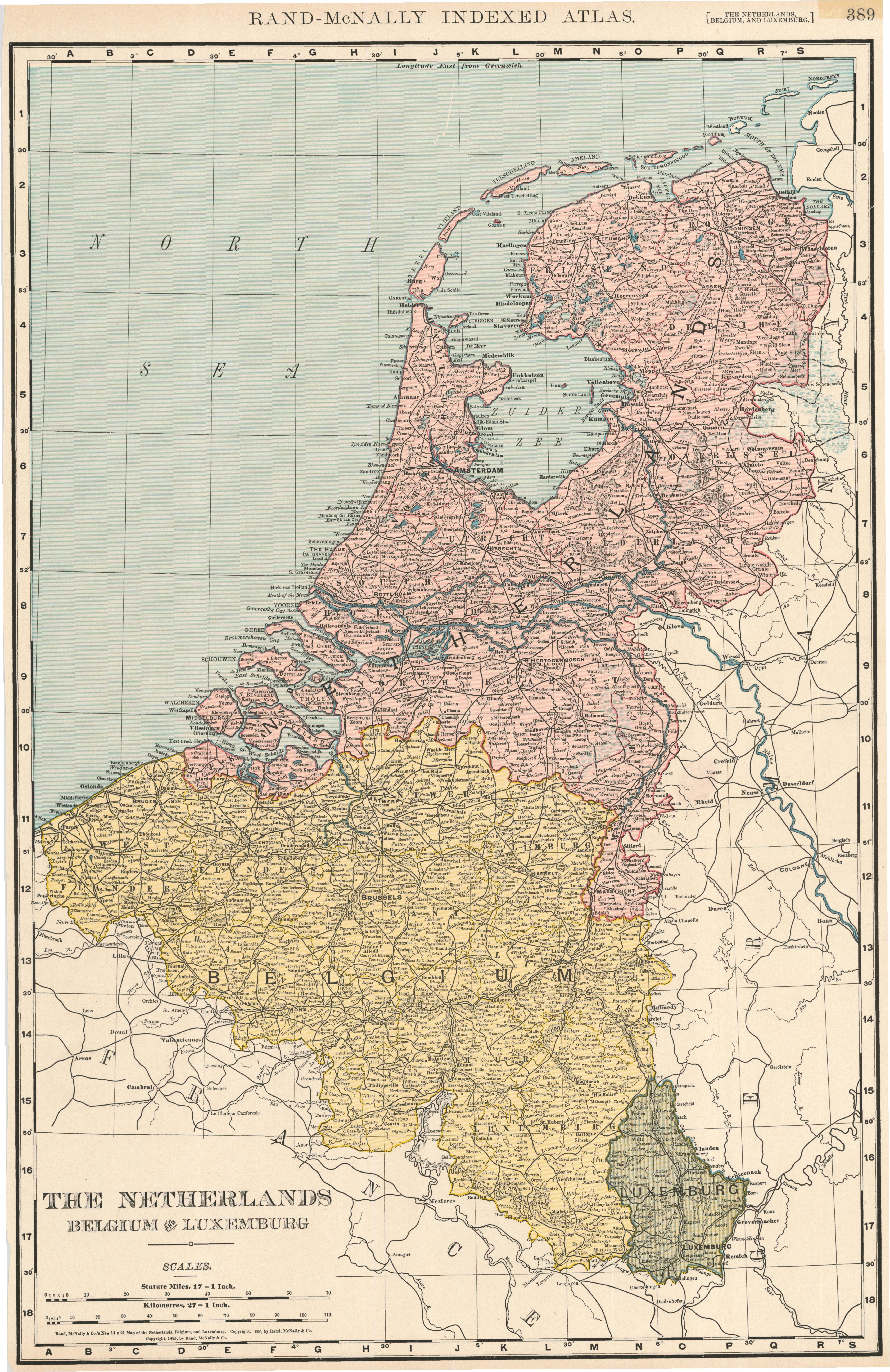
The Netherlands, Belgium and Luxemburg
Princeton University
Public content
IIIF Service
Description:
Relief shown by hachures. In upper margin: Rand-McNally indexed atlas. 389. Index on verso. From: Rand McNally & Co.'s Indexed atlas of the world ... Chicago : Rand, McNally & Company, [c1905]
Creator:
Rand McNally and Company
Publisher:
[Chicago] : Rand McNally & Co., c1905.
Provider:
Princeton
Resource Type:
Satellite imagery
Subject:
Belgium—Maps
,
Luxembourg—Maps
,
Netherlands—Maps
,
Maps—Belgium—1905
,
Maps—Luxembourg—1905
, and
Maps—Netherlands—1905
Spatial Coverage:
Netherlands
,
Belgium
, and
Luxembourg
Access Rights:
Public
Format:
TIFF
More details at:
https://catalog.princeton.edu/catalog/6942836
Location
Tools
Cite
Web services
Download
Original TIFF
Original JPG