Skip to search
Skip to main content
History
Login
search for
Search
Search
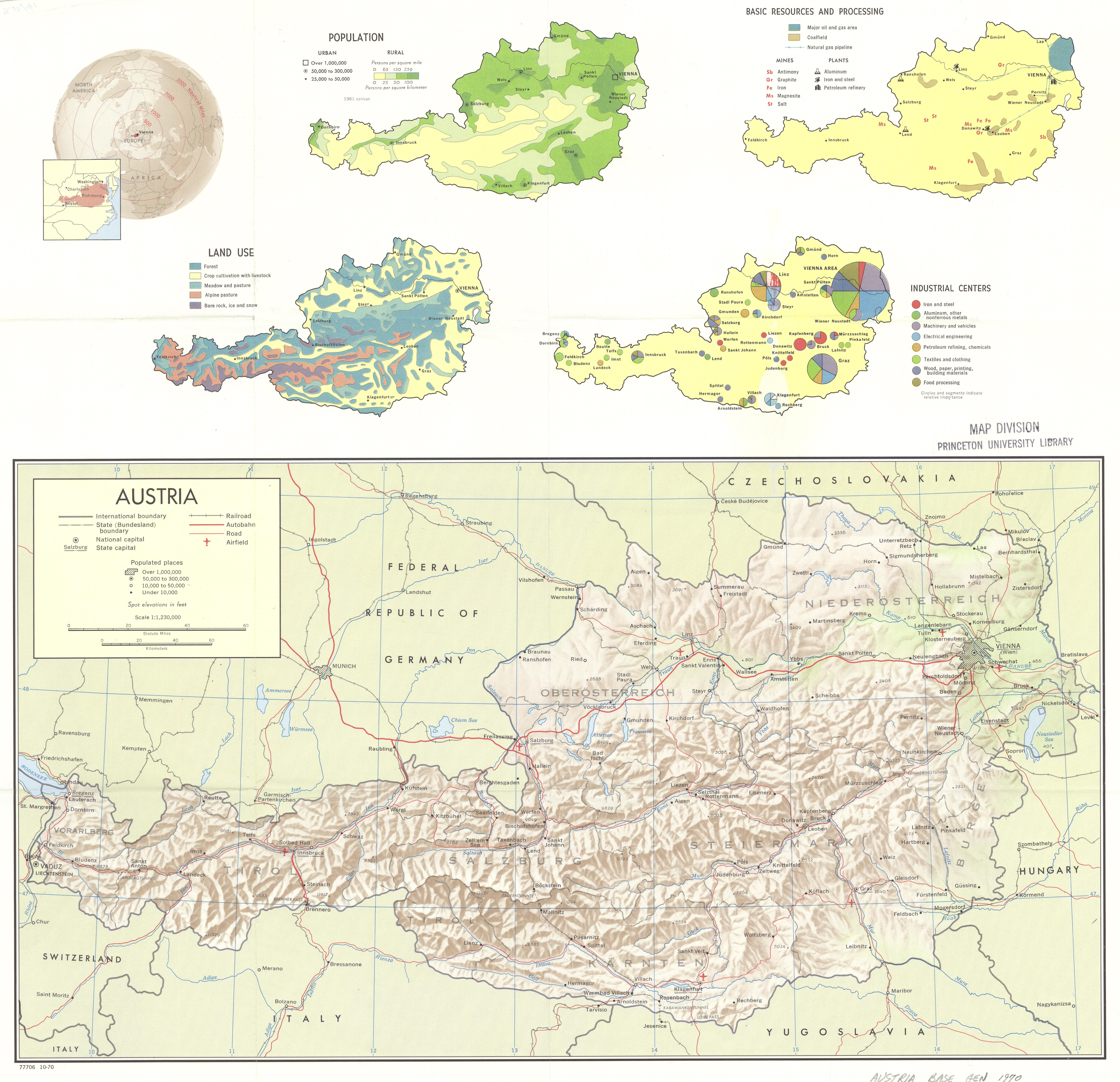
Austria, 1970 (with relief)
Princeton University
Public content
IIIF Service
Description:
This is a map of Austria with relief that shows land use, industries, population and resources. The map was created by the Central Intelligence Agency.
Creator:
Central Intelligence Agency
Publisher:
Central Intelligence Agency
Provider:
Princeton
Resource Type:
Satellite imagery
Subject:
Petroleum
,
Administrative and Political Boundaries
,
Land use
,
Railroads
,
Transportation
,
Population
,
Industry
, and
Roads
Temporal Coverage:
1970
Spatial Coverage:
Austria
and
Europe
Access Rights:
Public
Format:
TIFF
Location
Tools
Cite
Metadata
Web services
Download
Original TIFF
Original JPG