View Metadata
Error:
The metadata view for selected schema is not available
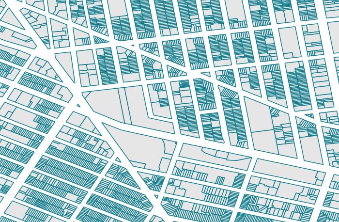
<?xml version="1.0"?> <mods xmlns="http://www.loc.gov/mods/v3" xmlns:xsi="http://www.w3.org/2001/XMLSchema-instance" xmlns:rdf="http://www.w3.org/1999/02/22-rdf-syntax-ns#" xmlns:xlink="http://www.w3.org/1999/xlink" version="3.7" xsi:schemaLocation="http://www.loc.gov/mods/v3 http://www.loc.gov/standards/mods/v3/mods-3-7.xsd"> <titleInfo> <title>City Boundaries: Santa Clara County, California, 2015</title> </titleInfo> <name type="corporate"> <namePart>Santa Clara County (Calif.). Planning Office</namePart> <role> <roleTerm authority="marcrelator" type="text">creator</roleTerm> </role> </name> <genre valueURI="http://id.loc.gov/authorities/genreForms/gf2011026297" authority="lcgft">Geospatial data</genre> <genre valueURI="http://rdvocab.info/termList/RDAContentType/1001" authority="rdacontent">cartographic dataset</genre> <genre>Dataset</genre> <typeOfResource>cartographic</typeOfResource> <typeOfResource>software, multimedia</typeOfResource> <physicalDescription> <form>Shapefile</form> <digitalOrigin>born digital</digitalOrigin> </physicalDescription> <language> <languageTerm authority="iso639-2b" type="code">eng</languageTerm> </language> <abstract displayLabel="Abstract">This polygon shapefile depicts administrative boundaries for cities over which the County of Santa Clara, California holds authority: Campbell, Cupertino, Gilroy, Los Altos, Los Altos Hills, Los Gatos, Milpitas, Monte Sereno, Morgan Hill, Mountain View, Palo Alto, San Jose, Santa Clara, Saratoga and Sunnyvale. This coverage does not include unincorporated areas. These boundaries have been approved by the Local Agency Formation Commission (LAFCO) of Santa Clara County. LAFCO was created in 1963 to encourage orderly formation of local government agencies, preserve agricultural land resources and discourage urban sprawl. LAFCO is are responsible for coordinating logical and timely changes in local governmental boundaries, conducting special studies that review ways to reorganize, simplify, and streamline governmental structure and preparing a sphere of influence for each city and special district within each county. This layer is part of a collection of GIS data for Santa Clara County, California.</abstract> <note displayLabel="Purpose" type="other">The Santa Clara County Planning Office is part of the Department of Planning and Development. Their primary function is to plan and regulate land use and development within the unincorporated portions of Santa Clara County. Other responsibilities include policy analysis, GIS services, research and technical assistance relating to land use, housing, environmental protection, historic preservation and demographics. The Geographic Information Services Department has taken on all those activities related to GIS data and GIS process and procedures that cross organizational boundaries. Santa Clara County encompasses 15 cities and approximately 1.7 million people. This coverage can be used for basic applications such as viewing, querying, and map output production, or to provide a basemap to support graphical overlays and analyses of geospatial data.</note> <subject authority="geonames"> <geographic authority="geonames" authorityURI="http://www.geonames.org/ontology#" valueURI="http://sws.geonames.org/5393021/">Santa Clara County (Calif.)</geographic> </subject> <subject authority="geonames"> <geographic authority="geonames" authorityURI="http://www.geonames.org/ontology#" valueURI="http://sws.geonames.org/5333689/">Campbell (Calif.)</geographic> </subject> <subject authority="geonames"> <geographic authority="geonames" authorityURI="http://www.geonames.org/ontology#" valueURI="http://sws.geonames.org/5341145/">Cupertino (Calif.)</geographic> </subject> <subject authority="geonames"> <geographic authority="geonames" authorityURI="http://www.geonames.org/ontology#" valueURI="http://sws.geonames.org/5352214/">Gilroy (Calif.)</geographic> </subject> <subject authority="geonames"> <geographic authority="geonames" authorityURI="http://www.geonames.org/ontology#" valueURI="http://sws.geonames.org/5368335/">Los Altos (Calif.)</geographic> </subject> <subject authority="geonames"> <geographic authority="geonames" authorityURI="http://www.geonames.org/ontology#" valueURI="http://sws.geonames.org/5368346/">Los Altos Hills (Calif.)</geographic> </subject> <subject authority="geonames"> <geographic authority="geonames" authorityURI="http://www.geonames.org/ontology#" valueURI="http://sws.geonames.org/5368518/">Los Gatos (Calif.)</geographic> </subject> <subject authority="geonames"> <geographic authority="geonames" authorityURI="http://www.geonames.org/ontology#" valueURI="http://sws.geonames.org/5373327/">Milpitas (Calif.)</geographic> </subject> <subject authority="geonames"> <geographic authority="geonames" authorityURI="http://www.geonames.org/ontology#" valueURI="http://sws.geonames.org/5374283/">Monte Sereno (Calif.)</geographic> </subject> <subject authority="geonames"> <geographic authority="geonames" authorityURI="http://www.geonames.org/ontology#" valueURI="http://sws.geonames.org/5374764/">Morgan Hill (Calif.)</geographic> </subject> <subject authority="geonames"> <geographic authority="geonames" authorityURI="http://www.geonames.org/ontology#" valueURI="http://sws.geonames.org/5375480/">Mountain View (Calif.)</geographic> </subject> <subject authority="geonames"> <geographic authority="geonames" authorityURI="http://www.geonames.org/ontology#" valueURI="http://sws.geonames.org/5380748/">Palo Alto (Calif.)</geographic> </subject> <subject authority="geonames"> <geographic authority="geonames" authorityURI="http://www.geonames.org/ontology#" valueURI="http://sws.geonames.org/5392171/">San Jose (Calif.)</geographic> </subject> <subject authority="geonames"> <geographic authority="geonames" authorityURI="http://www.geonames.org/ontology#" valueURI="http://sws.geonames.org/5393015/">Santa Clara (Calif.)</geographic> </subject> <subject authority="geonames"> <geographic authority="geonames" authorityURI="http://www.geonames.org/ontology#" valueURI="http://sws.geonames.org/5393485/">Saratoga (Calif.)</geographic> </subject> <subject authority="geonames"> <geographic authority="geonames" authorityURI="http://www.geonames.org/ontology#" valueURI="http://sws.geonames.org/5400075/">Sunnyvale (Calif.)</geographic> </subject> <subject authority="lcsh"> <topic authority="lcsh" authorityURI="http://id.loc.gov/authorities/subjects">Administrative and political divisions</topic> </subject> <subject authority="lcsh"> <topic authority="lcsh" authorityURI="http://id.loc.gov/authorities/subjects">Cities and towns</topic> </subject> <subject authority="ISO19115TopicCategory"> <topic authority="ISO19115TopicCategory" authorityURI="http://www.isotc211.org/2005/resources/Codelist/gmxCodelists.xml#MD_TopicCategoryCode">Boundaries</topic> </subject> <subject authority="ISO19115TopicCategory"> <topic authority="ISO19115TopicCategory" authorityURI="http://www.isotc211.org/2005/resources/Codelist/gmxCodelists.xml#MD_TopicCategoryCode">Society</topic> </subject> <subject authority="ISO19115TopicCategory"> <topic authority="ISO19115TopicCategory" authorityURI="http://www.isotc211.org/2005/resources/Codelist/gmxCodelists.xml#MD_TopicCategoryCode">Planning and Cadastral</topic> </subject> <subject> <temporal encoding="w3cdtf">2015</temporal> </subject> <subject> <cartographics> <projection>EPSG::2227</projection> <coordinates>W 122°12ʹ19ʺ--W 121°31ʹ7ʺ/N 37°29ʹ6ʺ--N 36°57ʹ54ʺ</coordinates> </cartographics> </subject> <originInfo> <dateIssued encoding="w3cdtf" keyDate="yes">2015</dateIssued> <dateValid encoding="w3cdtf">2015</dateValid> <publisher>Santa Clara County (Calif.). Planning Office</publisher> </originInfo> <location> <url usage="primary display">https://purl.stanford.edu/ht248yt3124</url> </location> <recordInfo> <languageOfCataloging> <languageTerm authority="iso639-2b" type="code">eng</languageTerm> </languageOfCataloging> <recordContentSource>Stanford</recordContentSource> <recordCreationDate encoding="w3cdtf">2016-02-22</recordCreationDate> <recordIdentifier>edu.stanford.purl:ht248yt3124</recordIdentifier> </recordInfo> <extension displayLabel="geo"> <rdf:RDF xmlns:gml="http://www.opengis.net/gml/3.2/" xmlns:dc="http://purl.org/dc/elements/1.1/"> <rdf:Description rdf:about="http://purl.stanford.edu/ht248yt3124"> <dc:format>application/x-esri-shapefile; format=Shapefile</dc:format> <dc:type>Dataset#Polygon</dc:type> <gml:boundedBy> <gml:Envelope gml:srsName="EPSG:4326"> <gml:lowerCorner>-122.20267788471786 36.972352118147384</gml:lowerCorner> <gml:upperCorner>-121.51881025483259 37.478949733618016</gml:upperCorner> </gml:Envelope> </gml:boundedBy> </rdf:Description> </rdf:RDF> </extension> <relatedItem type="host"> <titleInfo> <title>Santa Clara County, California GIS Maps & Data</title> </titleInfo> <location> <url>https://purl.stanford.edu/zr514ds1803</url> </location> <typeOfResource collection="yes"/> </relatedItem> <accessCondition type="useAndReproduction">This item is in the public domain. There are no restrictions on use.</accessCondition> <accessCondition type="copyright">This work is in the Public Domain, meaning that it is not subject to copyright.</accessCondition> </mods>
The metadata view for selected schema is not available
Please select another metadata view. Alternately, try downloading the file or reaching out to the holding institution.